Pukerangiora was once an expansive and thriving pre-European pā and later the site of significant conflicts during both the Musket Wars and the Taranaki Wars. These events fundamentally changed New Zealand’s history, yet the stories remained largely held by subject specialists and mana whenua knowledge holders.
When Locales was approached by the Department of Conservation and Pukerangiora Hapū in 2019, Pukerangiora Pā was a historic reserve lacking any visitor infrastructure or interpretation. Over the next seven years, Locales worked closely alongside Pukerangiora Hapū and the Department to transform the site into a meaningful visitor experience.
It was about bringing the stories and the people back to the land while revitalising the landscape in a way that hapū can proudly claim as their own.
Locales developed the visitor experience concept, supported funding applications, and delivered the spatial design, interpretive signage, wayfinding, graphic design, website, and mobile guide. We based the storytelling and design on in-depth oral history interviews and consultation with archaeological experts.
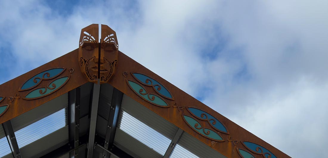
Tomokanga and Amphitheatre
The Tomokanga and Amphitheatre are the main points of arrival for visitors.
The carved elements of the structures were developed in collaboration with local hapū artist Rumatiki Timu.
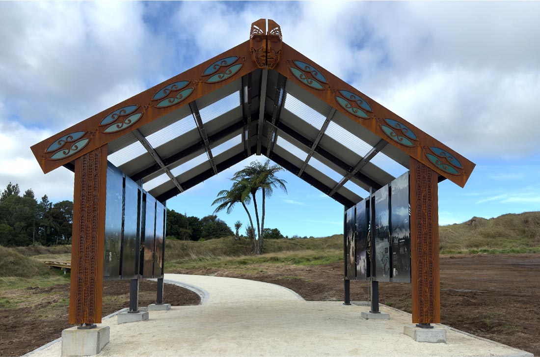
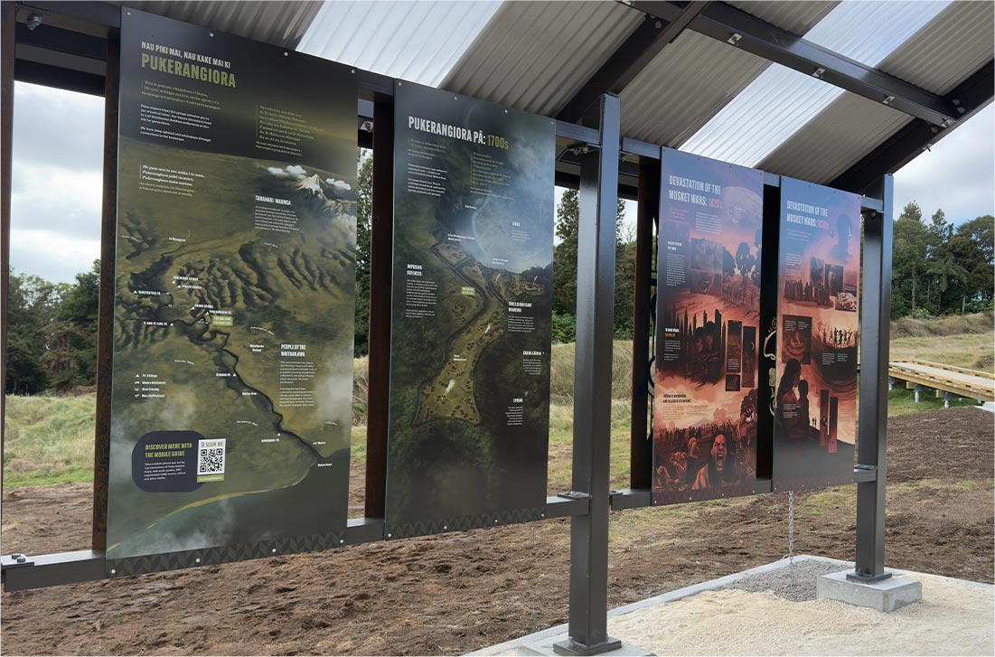
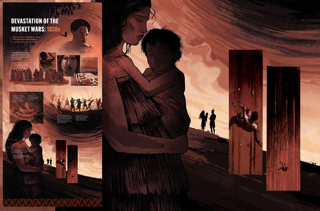
Within the Tomokanga, a series of graphic-novel-style interpretive panels tell the story of Pukerangiora Pā. The graphics were illustrated entirely in-house, ensuring cultural accuracy and sensitivity throughout the iterative design process. The result is a gorgeous visual narrative that’s maintained throughout the entire project. Colour coding helps visitors navigate the complex layers of the site.
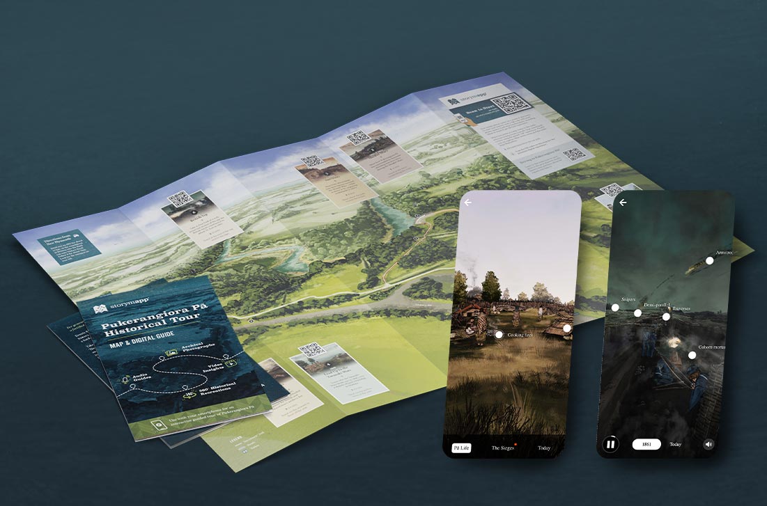
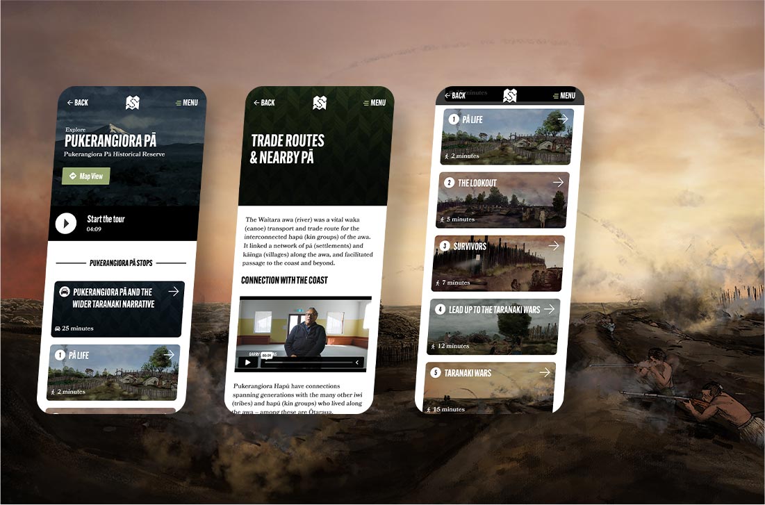
Mobile Guide
Along the trail, visitors encounter a series of Oral History Seats, each inviting them to explore a different chapter in the history of Pukerangiora.
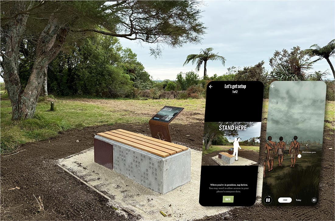
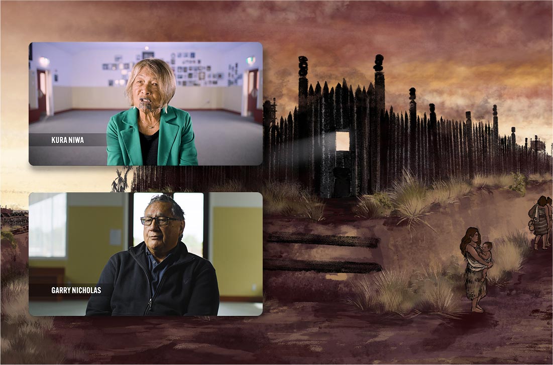
By scanning a QR code, visitors can access the mobile guide, featuring edited oral history videos of kaumatua and subject specialists sharing kōrero connected to each location and theme.
360˚ historical recreations bring the locations to life, showing what each location would have looked like at different times throughout the history of Pukerangiora Pā.
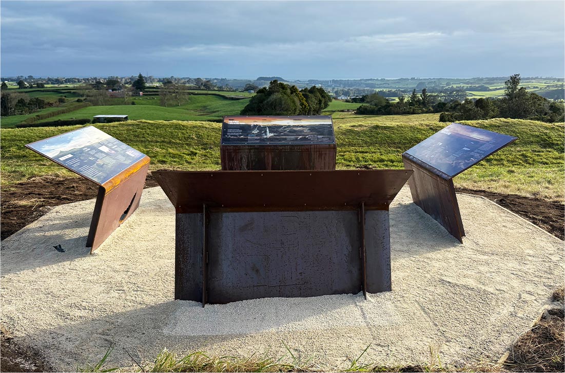
Lookouts
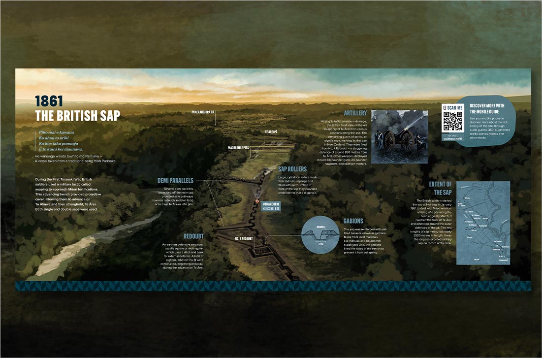
Three lookout points provide further opportunities to interpret significant locations within the reserve.
Designed to sit lightly within the landscape, the structures complement the surrounding environment and maintain the archaeological integrity of the site.
Each lookout offers deeper place-based interpretation, helping visitors understand the events and experiences associated with the Musket Wars and Taranaki Wars.
Website
Accompanying the entire experience is the website, pukerangiora.co.nz.
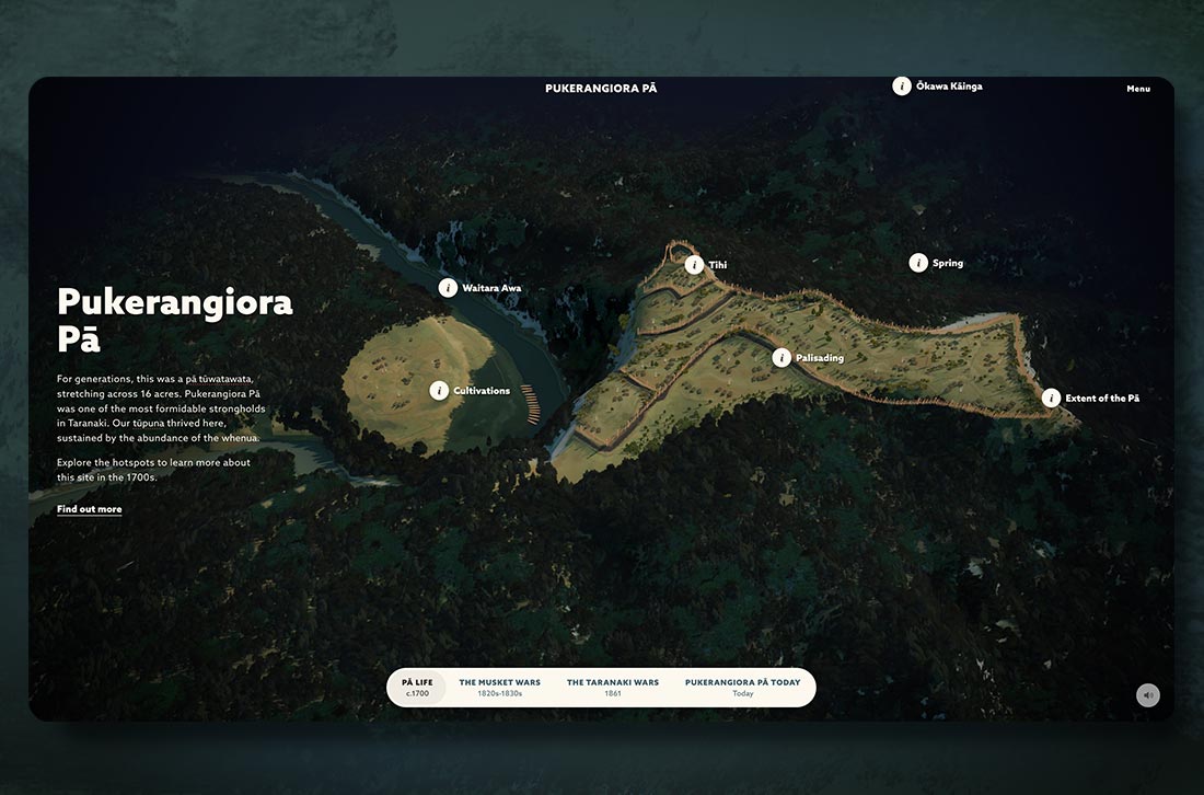
The website allows people to explore the stories of Pukerangiora from anywhere while also providing practical information for those planning a visit. A key feature is an interactive 3D model of the site, which provides a unique way to experience the site digitally. Education Kits also support educators in teaching the history of the site and its wider historical context.
Storymapp® and Storymapp® Box
A Storymapp® is available for purchase from the New Plymouth isite. This illustrated souvenir map provides additional layers of storytelling, unlocking exclusive content through QR codes linked to the mobile guide.
The Storymapp® Box, located within the isite, promotes the experience while helping visitors plan their wider journey through the region by highlighting nearby attractions and activities.